This will be a new piece of public land available for recreational use. The Parish Council wants to make this site into a beautiful community asset and look to rebuild the biodiversity and wildlife back that was lost during the construction of this land.
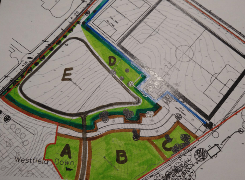
Below is a map which has had the areas marked out as a visual guide to the above proposal. It is appreciated that this is only a hand drawn guide but hopes to give a visual aid for the areas and plans for the site. The areas have been colour coded:
- Dark brown lines = potential fencing
- Dark green lines = hedgerows
- Light green areas = areas next to hedgerows are the sections for potential soft edges for the main hedgerows and or areas for tussocky grass-rich growth.
- Light green areas Sections A and B = potential areas for woodland buildouts or areas for encouraging a variety of planting and density and some scrubland.
- Light green area Section D = potential small woodland site which would also act as a screen to the football pitch.
Planting and Hedgerows
Due to the loss of biodiversity and habitat on the site there is an opportunity for building sustainable wildlife corridors and habitat throughout the site. The following suggestions are after reviewing the FWAG report, visited Arlington Reservoir and reviewed the High Weald guidance.
The main site shown as section E the Parish Council would also look to have the main central area to be largely open planned. It will have minimal tree planting allowing the space to be enjoyed as open recreational land giving people the opportunity to safely play sports on the site or partake in gentle recreational leisure such as walking and running.
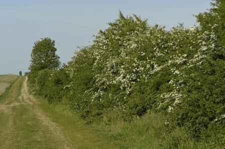
Westfield Parish Council are looking to hedge the edges of the Recreational Land with a wildlife mix to encourage wildlife corridors and provide food and shelter for local wildlife. Stock fencing will be installed all around the edges to keep users of the recreational land safe from the road. The planted hedges are intended to be cut on the roadside to keep them trim and close to the fence line but on the other side the intention is to allow a gradient hedgerow to grow out and encourage a tussocky grass-rich growth to develop at the base of the shrub layer. This is because a dense grassy ground cover is essential for many invertebrates including spiders, beetles, lies and caterpillars, both for overwintering and breeding.
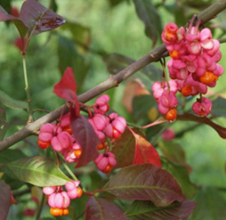
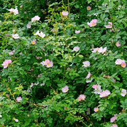
The photo on the right gives an idea of the style of hedge however the ones at the recreational land would only grow up to around 2 metres high. The hedge mix is including guelder rose and dog rose to provide a food source for wildlife but is also very beautiful. The other species included in the hedge mix would include alder, maple field, hawthorn, elder and dogwood shown in the images below.

There is the opportunity to allow oak trees to grow to full maturity within the hedge itself at regular intervals. This would increase the number of trees on site creating greater biodiversity for wildlife providing shelter, food and nesting for birds and bats whilst also providing shade for users of the recreational areas.
On top of this the Parish Council would look to have small build outs in certain areas where the Parish Council would increase the planting of shrubs, trees in certain areas to further encourage spaces for local wildlife to flourish. A potential area would be in front of the football pitch which could be a suitable build out for a small woodland area and also act and a screen for the fencing around the football pitch. This is shown as section D on the map. Sections A and B shown on the map could be built out as small woodland areas. These could be fenced off to allow these areas to be managed as small woodland and scrub land and would not affect the resident’s enjoyment of the main recreational area as it is in a separate part of the site.
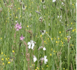
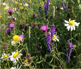
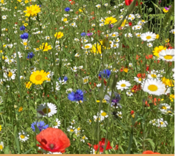
Where it would be suitable options will be looked at for planting wildflowers. In some spaces these would focus on colour and impact but these require a lot more management and in other areas it would focus on flowers that are not as visually bright but provide shelter and food for local wildlife and always aim to be native species rich in diversity for bees and butterflies.
Footpaths
With the main area being used as recreational land it is proposed to place a footpath around the edge of area E the main recreational area. Potential existing examples would be a similar footpaths that have been installed at Battle’s recreational ground and the playing field in Burwash Common.
The purpose of installing such a footpath would be for the following reasons:
- It allows users to use the reactional area in all seasons and most weather conditions.
- Anyone using a wheelchair or pushchair would have a route that they could use.
- The footpath would encourage people not to go onto the areas where the staggered hedges and tussocky grass-rich growth is being established and also creates a clear stop line so such growth does not encroach on the main recreation area.
- This footpath is not intended to stop or divert the existing right of way. This would remain open in the top left hand corner of the field and from the bottom in between sections A and B. Those using the public footpath when entering onto the main Westfield Down recreational area could either follow the original route or use the footpath. Councillors if they support a hard surfaced footpath being laid might want to extend the footpath to include the public footpath up to the entrance near the A28 or use a difference surface to tarmac or not lay a surface at all.
